Towards “Google Earth” for Structural Engineering
Digital technology has changed our life by providing automatic access to information at multiple scales. Wouldn’t it be great to have a “Google Earth”- style tool for structural engineering that allows us to automatically model and analyse regions, structures and structural details at very different scales?
Dr Carolin Birk presented the recent research undertaken at CIES towards this goal in her talk “Structural Analysis and Design: Towards Automation in Numerical Modelling” on Wednesday, 26 February 2014. Her presentation was one of three lectures in an event held by the NSW Institution of Civil Engineers Local Association.
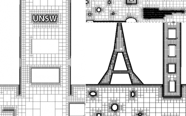
In her presentation, Carolin described a method to automatically create a quadtree mesh of polygon elements based on image analysis techniques. The polygon elements are developed using the scaled boundary finite element method. Besides automatic mesh generation, the quadtree approach allows for highly efficient automatic structural analysis, due to the limited number of possible element configurations.
The proposed approach can be used to perform model creation from engineering drawings or images and analysis in a simple and highly efficient way. It is a promising step towards automation in computer simulation. The extension to 3D is currently in development.
 |